


FOX Voting District, Kendall County, Illinois
About
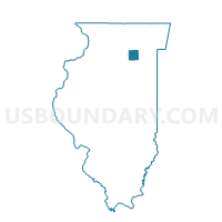
Outline

Summary
| Unique Area Identifier | 571795 |
| Name | FOX Voting District |
| County | Kendall County |
| State | Illinois |
| Area (square miles) | 36.64 |
| Land Area (square miles) | 36.17 |
| Water Area (square miles) | 0.47 |
| % of Land Area | 98.72 |
| % of Water Area | 1.28 |
| Latitude of the Internal Point | 41.59174280 |
| Longtitude of the Internal Point | -88.54888530 |
Maps


Graphs
Select a template below for downloading or customizing gragh for FOX Voting District, Kendall County, Illinois


Neighbors
Neighoring Voting District (by Name) Neighboring Voting District on the Map
- BIG GROVE 1 Voting District, Kendall County, IL
- BRISTOL 10 Voting District, Kendall County, IL
- KENDALL 3 Voting District, Kendall County, IL
- KENDALL 6 Voting District, Kendall County, IL
- LISBON Voting District, Kendall County, IL
- LITTLE ROCK 1 Voting District, Kendall County, IL
- LITTLE ROCK 3 Voting District, Kendall County, IL
- LITTLE ROCK 9 Voting District, Kendall County, IL
- MISSION 1 Voting District, LaSalle County, IL
- NORTHVILLE 1 Voting District, LaSalle County, IL
- NORTHVILLE 5 Voting District, LaSalle County, IL
- SANDWICH 3 Voting District, DeKalb County, IL
Top 10 Neighboring County Subdivision (by Population) Neighboring County Subdivision on the Map
- Bristol township, Kendall County, IL (26,230)
- Little Rock township, Kendall County, IL (13,076)
- Kendall township, Kendall County, IL (7,739)
- Sandwich township, DeKalb County, IL (7,709)
- Northville township, LaSalle County, IL (7,410)
- Mission township, LaSalle County, IL (3,972)
- Fox township, Kendall County, IL (1,675)
- Big Grove township, Kendall County, IL (1,647)
- Lisbon township, Kendall County, IL (899)
Top 10 Neighboring Place (by Population) Neighboring Place on the Map
- Yorkville city, IL (16,921)
- Sandwich city, IL (7,421)
- Newark village, IL (992)
- Millington village, IL (665)
- Millbrook village, IL (335)
Top 10 Neighboring Elementary School District (by Population) Neighboring Elementary School District on the Map
Top 10 Neighboring Secondary School District (by Population) Neighboring Secondary School District on the Map
Top 10 Neighboring Unified School District (by Population) Neighboring Unified School District on the Map
- Yorkville Community Unit School District 115, IL (28,319)
- Sandwich Community Unit School District 430, IL (13,473)
- Plano Community Unit School District 88, IL (11,288)
Top 10 Neighboring State Legislative District Lower Chamber (by Population) Neighboring State Legislative District Lower Chamber on the Map
Top 10 Neighboring State Legislative District Upper Chamber (by Population) Neighboring State Legislative District Upper Chamber on the Map
Top 10 Neighboring 111th Congressional District (by Population) Neighboring 111th Congressional District on the Map
Top 10 Neighboring Census Tract (by Population) Neighboring Census Tract on the Map
- Census Tract 8904, Kendall County, IL (26,230)
- Census Tract 8907, Kendall County, IL (15,257)
- Census Tract 8905, Kendall County, IL (13,076)
- Census Tract 8906, Kendall County, IL (9,414)
- Census Tract 9623, LaSalle County, IL (6,937)
- Census Tract 9617.01, LaSalle County, IL (6,355)
- Census Tract 9617.02, LaSalle County, IL (3,200)
- Census Tract 21, DeKalb County, IL (2,428)
Top 10 Neighboring 5-Digit ZIP Code Tabulation Area (by Population) Neighboring 5-Digit ZIP Code Tabulation Area on the Map
- 60560, IL (22,415)
- 60545, IL (12,940)
- 60548, IL (12,218)
- 60551, IL (5,062)
- 60541, IL (3,148)
- 60537, IL (665)
- 60536, IL (126)